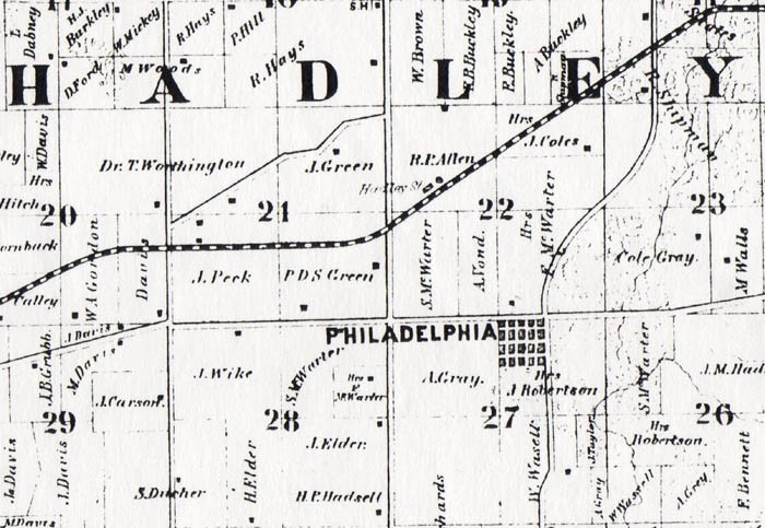
This excerpt from the 1860 Atlas Map of Pike County shows a portion of Hadley Township, including "Philadelphia" (shown here as a grid of town lots, with Frank McWorter's estate immediately to the north), surrounding properties, and the anticipated route of the railroad to the north of New Philadelphia. A new depot town named Hadley Station was also anticipated on this map. Planning and surveying of the prospective route for the new railroad through Pike County began in the early 1850s, and the railroad was finally constructed in 1869.
Compare this 1860 map with a similar map of the area from an 1872 Atlas. |