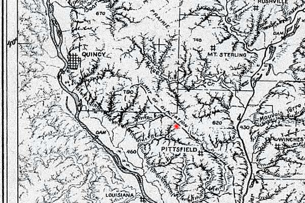
| The excerpt below, from a 1956 landform map by the State Geological Survey, shows the topography surrounding the former site of New Philadelphia, which was located in the area marked in red, between the Mississippi River valley to the west and the Illinois River valley to the east. The Geological Survey based this landform map primarily on data from quadrangle topographic maps. |
This and other historical maps are available from the University of Illinois at Urbana-Champaign's collection of historical maps of the state of Illinois and the Midwest and Northwest Territories.Maintained by |