| << Previous | || | Next >> |
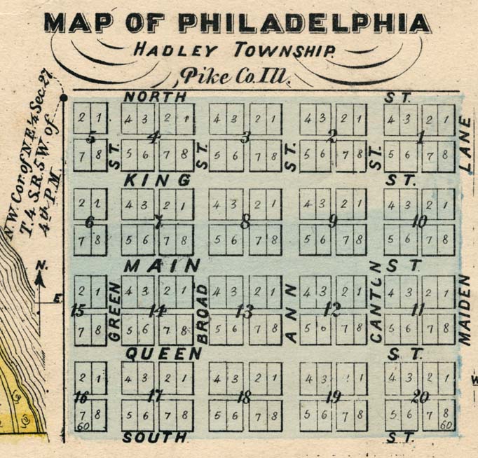
| This excerpt from the 1872 Atlas Map of Pike County shows the town lots and streets of Philadelphia, and depicts the lot designations in a manner consistent with the original plat laid out by Frank McWorter in 1836. (The drawing of a river's edge along the lower left margin of this image is from an adjacent inset map unrelated to Philadelphia.) . |
| << Previous Figure | || | Next Figure >> |