Maps and Images
of New Philadelphia, Illinois

2005 Aerial Photograph


dividing bar

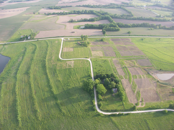
The photograph below was taken by Dr. Tommy Hailey of Northwestern State University, who conducted a low-altitude aerial survey of New Philadelphia in May, 2005. A number of the blocks and lots of the town area had been defined by survey markers and surface discing at the time this photo was taken. The farm and home site of Free Frank McWorter were located to the north of the town site, across a dirt road now covered by the blacktop road you see running from left to right in the upper half of this photo. You can also view this image with an overlay of the town's outer boundaries.

2005 aerial photograph

Source: Courtesy of Dr. Tommy Hailey.

Compare this 2005 photo with earlier aerial photographs:
1939 aerial photo without crop notations
1939 aerial photo with crop notations
1939 aerial photo with town lot overlay
1998 aerial photo
1998 aerial photo with town lot overlay
Compare these aerial photos with 1990 topographic maps:
Larger scale map
Medium scale map
Closer scale map


dividing bar


Return to New Philadelphia page

Map and Survey Index

Maintained by
Christopher Fennell