| This image shows an excerpt from a "Map of Illinois Constructed from the Surveys in the General Land Office and Other Documents by John Melish. Samuel Harrison, sct. Entered according to Act of Congress the 16th day of April 1816, Philadelphia [Pennsylvania]." This "improved" version was published in 1820. The excerpt below shows the "Military Bounty Land" area in western Illinois. The approximate location where new Philadelphia would be established in 1836 is marked in red. |
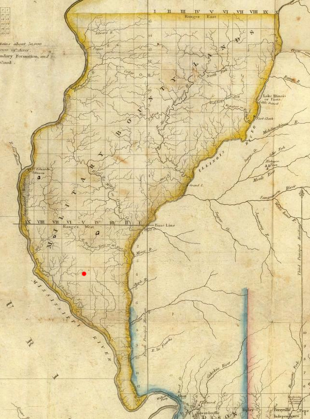
Sources: Digital reproduction available in David Rumsey Cartographic Collections.Maintained by |