|
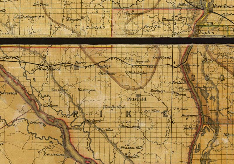
This excerpt from an 1861 sectional map of Illinois was compiled and drawn by the State Topographer, Leopold Richter, to exhibit the legal boundaries of counties and topography such as towns, streams, lakes, ponds, bluffs, railroads, and roadways. Planned construction of the first rail line through Pike County, to link Naples, Illinois with Hannibal, Missouri and the Mississippi River, helped further invigorate area land sales and development in the 1860s. However, when this railroad was built in 1869, it bypassed New Philadelphia and had station stops at Barry and the new town of Hadley Station, formed in 1870. The depiction in this 1861 map of the "Pike County Rail Road" was likely conjectural, and based on working plans for its path. |