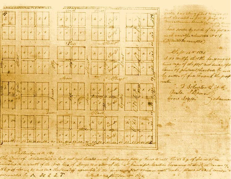
| This image shows the plat for the streets and town lots as laid out by Frank McWorter in the Pike County Deed records in 1836. Compare this plat with an 1872 map of Philadelphia's lots and streets, and a map of the vicinity presented in an 1860 Atlas. |
Sources: Pike County Deed Book, Vol. 9, 1836, p. 183; see also Juliet E. K. Walker, Free Frank: A Black Pioneer on the Antebellum Frontier, University Press of Kentucky, 1983, p. 104; Joy D. Beasley and Tom Gwaltney, New Philadelphia Project Field Walkover Survey: Interim Report, 2003, p. 1.Maintained by |