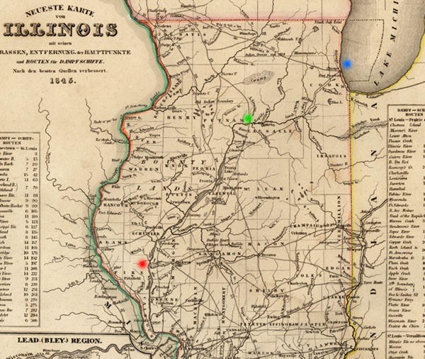
The 1830s and 1840s were periods of active land sales in the area of Pike County and the so-called "Military Tract" of western Illinois. One of the primary incentives for these land purchases was the planned construction of the Illinois-Michigan Canal. This excerpt from an 1845 map of Illinois shows the Illinois River running from the southwest portion of the State, including the area of Pike County, marked in red, up toward Chicago on Lake Michigan, marked in blue. The River did not reach Chicago, however, and the Illinois-Michigan Canal was constructed to link the River (near La Salle, Illinois, marked in green) to Lake Michigan at the growing port town of Chicago and the increasing flow of transport across the Great Lakes. Upon completion of the canal, goods were shipped with greater ease from the Great Lakes across the canal to the Illinois River and on to the interior counties of the state and the confluence of the Illinois and Mississippi Rivers to the south of Pike County. The canal was completed in 1848, operated throughout the late nineteenth century, and then fell into disuse after 1900.
The earlier impacts of such developments can be seen in comparing an 1845 map of the Pike County area, which shows an increased number of towns as compared with an earlier map published in 1836. |