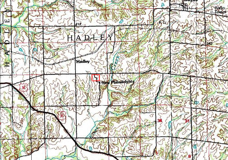
The July, 1990 map image below shows the area surrounding the site of New Philadelphia from the United States Geological Survey's database of digital raster maps, consisting of topographic maps which have been digitized and enhanced. The U.S.G.S. Geographic Names Information System indicates that the site of New Philadelphia was located at an elevation of 740 feet above sea level, and at 39 degrees, 41 minutes, 40 seconds North latitude and 90 degrees, 57 minutes, 30 seconds West longitude. The approximate outline of the town lot perimeter of New Philadelphia is indicated by the red rectangle.
On the map below, the site of New Philadelphia is located 1 mile from Hadley Station, and each black-lined rectangle is approximately 1 mile wide. Kiser Creek runs just to the east of New Philadelphia, from the area of Baylis to the northeast, down eventually to feed into the Mississippi River drainage to the southwest. |