|
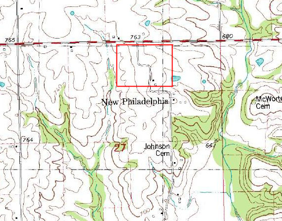
The July, 1990 map image below shows a closer view of the topography around the site of New Philadelphia from the United States Geological Survey's digital raster map data. On the map below, The Johnson Cemetery site is located approximately 600 yards (or 600 meters) from New Philadelphia. The scale distance on this image from the number "7" (of "27") to the "J" (of "Johnson") is approximately 200 yards (or 200 meters). The town lots of New Philadelphia lay immediately to the north of the town name as depicted on this map; the approximate perimeter of the town lots is indicated by the red rectangle. |