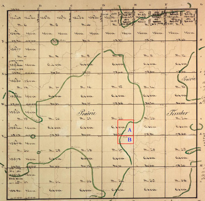
This excerpt of an 1830 Federal Township Plat for a portion of Hadley Township, in Pike County, is overlain with the boundaries of tracts (depicted by red rectangles) of land purchased by Frank McWorter and his sons in Hadley Township, Pike County, in the early 1830s, including tract B, on which New Philadelphia was platted in 1836. Tract A on this map contained approximately 160 acres and tract B held 80 acres. The green, meandering boundaries are part of the original plat survey, and mark the transitions from areas of prairie to timber.
The broader area of this region is also shown in maps published in 1820 and 1836.
|