Overview
This course will address analytic frameworks for spatial analysis of social dynamics, ways of modeling spatial relationships, and methods used in locating, recording, and mapping archaeological sites. We will focus on various strategies and techniques for formulating survey plans, interpreting data, and presenting results through work at both the theoretical and applied levels, in the field and the classroom.
In the Fall 2017 semster, we are scheduled to meet Tuesdays, from 9:00am to 11:50am in Room 109A in Davenport Hall.
I have created a course web page for Archaeological Surveying using the University's new Compass program. You can access the course web page by logging onto the Compass system, which will display all existing web pages for your courses. The log-on page is available at:
https://compass.illinois.edu . Choose Anth. 451 from the display list and you can access the course syllabus, assignments, lecture notes and illustrations, and other online class resources.
Course Requirements and Policies

The course is organized around reading, class presentations, and critical discussions. We will also engage in hands-on training with field surveying equipment and discussion of strategies for conducting fieldwork tasks as efficiently and effectively as possible. Field exercises will be carried out on the campus grounds. Responsibilities for class presentations and leading discussion of the readingsĀwill be rotated among class participants.ĀThere will also be occasional lectures to offer background on theoretical issues and particular methodological topics. The quality of your course experience will depend in large part on your willingness read thoughtfully and participate actively in class discussions and field exercises. This course will provide you with the opportunity to hone your skills in articulating significant arguments presented within a particular range of archaeological studies. The course also provides a supportive environment in which to practice your skills at written exposition, classroom debate, public presentations, and fieldwork. Thus, this is largely a reading, discussion, and fieldwork course intended for advanced undergraduate and graduate students with backgrounds in anthropology and archaeology.
Your grade in this course will be based on your performance in completing the following assignments:
1. Class Discussion (20 percent of course grade).Class participants should come to class prepared to discuss critically the week's readings. As you consider the readings work to highlight significantĀtheoretical and methodological themes that emerge in the articles, the manner in which they relate to one another and to previous topics discussed in the course, and their implications for archaeological practice. For example, you should ask questions such as: Do the authors' positions agree?ĀDo you find their arguments persuasive?ĀHow do they fit (or fail to fit) with other anthropological and archaeological ideas you find helpful or attractive?ĀA key focus of your consideration can be the manner in which abstract theoretical models or particular methodological approaches are implemented in studying the archaeological record.ĀIf particular patterns in the archaeological record are discussed and explained in an assigned reading, can you think of other ways to account for them?ĀIf particular methodological approaches are taken in an assigned reading, can you see weaknesses and strengths in those methods, or alternative ways one could approach the same subject?
2. Field Exercise Participation (10 percent of course grade). In Weeks 9-14 of the course, we will engage in laboratory and field exercises with various techniques of conducting archaeological surveys. Your attendance and thoughtful participation in these exercises will be to your benefit.
3. Short Essay (20 percent of course grade).ĀIn Week 8 of the course, you will each complete and hand in a 5-6 page introductory essay entitled "Space: My First Frontier" and present a short oral synopsis (5-10 minutes) in class.Ā In writing the essay, you should draw on the assigned readings, class presentations, discussions, and your own insights.ĀThis is a first opportunity for you to outline your vision of just what you find interesting in the tasks of developing frameworks for spatial analysis of social dynamics, ways of modeling spatial relationships, and methods used in locating, recording, and mapping archaeological sites. After revision, this short paper should become the introductory section of a longer seminar paper (see below). Absent excusable reasons, the grade for any writing assignment will be reduced if a student submits the completed assignment late (by ten percent for each day it is late).
4.ĀSeminar Paper (40 percent of course grade).Ā During the last three weeks of the course, participants will complete drafts of their seminar paper, which should be 15-20 pages in length for undergraduates or 20-25 pages in length for graduate students.ĀIn the seminar paper, you will explore a particular aspect of spatial analysis or archaeological surveying that interests you.ĀYour paper can have a theoretical (e.g., strengths and weaknesses in different regional systems models), methodological (e.g., a research design for conducting a particular form of survey),Āor substantive focus (e.g., a spatial analysis of social relationships across a particular time period and set of locations).Ā A revised version of your short essay ("Space: My First Frontier") should serve as the conceptual foundation for this effort and as the introductory section of your seminar paper.ĀThe focus of the rest of the paper is up to you, but it needs to be cleared in advance with the instructor.ĀAn abstract and outline of your seminar paper, with a list of key bibliographic references, is due in class at the beginning of Week 11. The final seminar paper is due by 5:00 pm on Dec. 21, which is the last day of the final examination period as scheduled by the University.
5.ĀSeminar Paper Presentation and Discussion (10 percent of course grade). During the last two to three weeks of the course, each participant will present in class a 15-minute synopsis of theĀseminar paper.ĀThis will be followed by 10-minute evaluation and comment by a designated discussant. Following a response by the author, the floor will be opened to general discussion.ĀDrafts of the seminar paper will be distributed one week before this presentation to all class members, including the designated discussant. These discussions are in the format of a workshop, to provide each class participant with helpful feedback and suggestions on the seminar paper.
Texts
 Field Methods in Archaeology, by Thomas R. Hester, Harry J. Shafer, and Kenneth L. Feder, Routledge, 7th ed. 2009 (required) (paperback, ISBN 978-1598744286). I will also place copies on reserve in the Undergraduate library Field Methods in Archaeology, by Thomas R. Hester, Harry J. Shafer, and Kenneth L. Feder, Routledge, 7th ed. 2009 (required) (paperback, ISBN 978-1598744286). I will also place copies on reserve in the Undergraduate library
Archaeological Survey, by James M. Collins and Brian L. Molyneaux, Alta Mira Press, 2003 (required) (paperback, ISBN 978-0759100213). I will also place one or two copies on reserve in the Undergraduate library.
Sampling in Archaeology, by Clive Orton, Cambridge University Press, 2000 (suggested, not required).
The texts listed above are available at the University bookstores and can also be obtained from other vendors of your choosing.
Other required readings consist of short articles or text excerpts addressing the subjects of this course. These articles will be available online in the course web page I have created using the University's Compass program.
I have provided below, following the "Class Schedule" section of the syllabus, a bibliography of additional print sources and a list of internet resources related to the subjects of archaeological surveying. These source lists should be helpful for students in choosing topics for their seminar papers and conducting research related to the course. Additional internet resources on anthropology and archaeology are available at:
http://faculty.las.illinois.edu/cfennell/bookmark2.html.
Class Schedule and Readings:
Week 1. Aug. 29. Overview of Course & Introduction.
Our course introduction will include a lecture and discussion on the multiple scales of past spatial interactions and related strategies for conducting archaeological surveys.
Read Collins & Molyneaux, pp. 1-22. |
Week 2. Sept. 5. Spatial Models in Research Questions and Predictive Surveys.
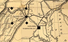
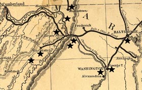
Read: Carol A. Smith, "Examining Stratification Systems through Peasant Marketing Arrangements: An Application of Some Models from Economic Geography," Man 10(1): 95-122 (1975); Pamela Cressey et al., "The Core-Periphery Relationship and the Archaeological Record in Alexandria, Virginia," in Archaeology of Urban America: The Search for Pattern and Process, edited by Roy S. Dickens, Jr., pp. 143-73 (New York: Academic Press 1982).
Scan: Philip L. Kohl, "The Use and Abuse of World Systems Theory: The Case of the Pristine West Asian State," in Advances in Archaeological Method and Theory, Volume 11, edited by Michael B. Schiffer, pp. 1-35 (New York: Academic Press 1987). |
Week 3. Sept. 12. Research Design and Sampling Techniques.
Read Hester et al., Chapter 3, pp. 21-40; Hester et al., Chapter 4, pp. 41-52; Stephen Plog, "Relative Efficiencies of Sampling Techniques for Archaeological Surveys," in The Early Mesoamerican Village, edited by Kent Flannery, pp. 136-58 (New York: Academic Press 1976).
Scan Stephen Plog, Fred Plog, and Walter Wait, "Decision Making in Modern Surveys," in Advances in Archaeological Method and Theory, Volume 1, edited by Michael B. Schiffer, pp. 383-421 (New York: Academic Press 1978); Clive Orton, Sampling in Archaeology, pp. 1-39 (Cambridge: Cambridge University Press 2000). |
Week 4. Sept. 19. Surface and Subsurface Survey Techniques.
Read Hester et al., Chapter 4, pp 53-59; Collins & Molyneaux, pp. 35-75; Stephen A. Kowalewski, "Merits of Full-Coverage Survey: Examples from the Valley of Oaxaca, Mexico," in The Archaeology of Regions: The Case for Full Coverage Survey, edited by Suzanne Fish and Stephen Kowalewski, pp. 33-83 (Washington, D.C.: Smithsonian Press 1990); (note: while this week's readings may appear lengthy, these sources include extensive graphic illustrations). |
Week 5. Sept. 26. Remote Sensing Survey Techniques: From Satellites to Metal Detectors.
Read Hester et al., Chapter 4, pp. 59-63; Hester et al., Chapter 9, pp. 177-80; Collins & Molyneaux, pp. 77-97, 99-102; William Saturno et al., "Putting Us on the Map: Remote Sensing Investigation of the Anicent Maya Landscape," in Remote Sensing in Archaeology, edited by James Wiseman and Farouk El-Baz, pp. 137-60 (New York: Springer 2007); Payson Sheets and Thomas L. Sever, "Creating and Perpetuating Social Memory Across the Ancient Costa Rican Landscape," in Remote Sensing in Archaeology, edited by James Wiseman and Farouk El-Baz, pp. 161-84 (New York: Springer 2007); Michael Hargrave, Geophysical Investigations at the New Philadelphia Site, Pike County, Illinois, available online at http://faculty.las.illinois.edu/cfennell/NP/Geophys/geophysics.html.
Scan NASA, Remote Sensing Archaeology Research at NASA, available online at https://weather.msfc.nasa.gov/archeology/; Aerial Archaeology Research Group, Introduction to Aerial Archaeology, available online at http://www.univie.ac.at/aarg/index.php/introduction.html; Larry Conyers, Ground Penetrating Radar in Archaeology, available online at http://mysite.du.edu/~lconyer/what_is_gpr.htm.
Our discussions of remote sensing techniques will also likely be continued in the first part of our class meeting time in Week 6.
|
 |
Week 6. Oct. 3. Organizing a Surface Survey: Maps, Mapping, Transects, and Grids.
Read Hester et al., Chapter 9, pp. 177-97; Collins & Molyneaux, pp. 23-34; Eve Gregory, Plotting Old Virginia Land Patent and Deed Boundary Descriptions, available online at http://www.rootsweb.com/~vavfar/How2plt.html; Eve Gregory, The Old Compass, available online at http://www.rootsweb.com/~vavfar/compass.html; and Eve Gregory, Bearing Equivalent Table for the Old Compass, available online at http://www.rootsweb.com/~vavfar/bearing8.html.
Scan Illinois State Archives, Federal Township Plats of Illinois, 1804-1891, available online at http://landplats.ilsos.net/ and the National Survey Museum's online presentation concerning basic survey instruments and tools. |
Week 7. Oct. 10. GIS and Computer-Aided Mapping for Predictive and Descriptive Models.
Read Hester et al., pp. 225-34; Collins & Molyneaux, pp. 108-10; Richard B. Duncan and Kristen A. Beckman, "The Application of GIS Predictive Site Location Models within Pennsylvania and West Virginia," in Practical Applications of GIS for Archaeologists: A Predictive Modeling Toolkit, edited by Konnie L. Wescott and R. Joe Brandon, pp. 33-58 (London: Taylor & Francis 2000); Konnie L. Wescott and James A. Kuiper, "Using GIS to Model Prehistoric Site Distributions in the Upper Chesapeake Bay," in Practical Applications of GIS for Archaeologists: A Predictive Modeling Toolkit, edited by Konnie L. Wescott and R. Joe Brandon, pp. 59-72 (London: Taylor & Francis 2000).
Scan Martin D. Gallivan, Spatial Analaysis of John Smith's Map of Virginia, Journal of Middle Atlantic Archaeology 13:145-60 (1997); Harrison Eiteljorg, II, Center for the Study of Architecture "Introduction and Basic Matters," in CAD Guide for Archaeologists and Architectural Historians, available online at http://csanet.org/inftech/cadgd/cadgdone.html (providing examples of basic CAD illustration and modeling capabilities). |
Week 8. Oct. 17. Survey Applications.
Using GIS for predictive or interpretative modelling.
Class does not meet today. Instead, allocate this week's class time to register, at your discretion, for a workshop on GIS program training. Such workshops are offered by the University's Library system, with a schedule of Fall semester workshops available at https://www.library.illinois.edu/sc/gis/workshops/.
Deadline: Short essay due today, to be delivered by email; each participant will present a short oral synopsis (5-10 minutes) of their essay in our class session on Oct. 24. |
Week 9. Oct. 24. Survey Applications.
Field exercises in using compass, transit, basic GPS, and submeter GPS.
Read Hester et al., Chapter 9, pp. 198-215; Collins & Molyneaux, pp. 104-08; equipment operations manual excerpts. |
Week 10. Oct. 31. Survey Applications.
Field exercises in using compass, transit, basic GPS, and submeter GPS.
Read Hester et al., Chapter 9, pp. 198-215; Collins & Molyneaux, pp. 104-08; equipment operations manual excerpts. |
Week 11. Nov. 7. Survey Applications.
Field exercises in using a theodolite or total station.
Read Hester et al., Chapter 9, pp. 215-25; equipment operations manual excerpts.
Deadline: An abstract and outline of your seminar paper project, with a list of key bibliographic references, is due in class today.
|
Week 12. Nov. 14. Survey Applications.
Field exercises in using a theodolite or total station.
Read Hester et al., Chapter 9, pp. 215-25; equipment operations manual excerpts. |
Nov. 18-26. Thanksgiving Break!
Classes do not meet. |
Week 13. Nov. 28. Presentations.
Field exercises; start workshop presentations of research projects. |
Week 14. Dec. 5. Presentations.
Workshop presentations of research projects. |
Week 15. Dec. 12. Presentations.
Workshop presentations of research projects. |
Final Seminar Paper.
The final seminar paper is due by 5:00 pm on Dec. 21, which is the last day of the final examination period as scheduled by the University. |
Bibliography of Additional Sources related to Archaeological Surveying
Aberg, A., and C. Lewis, eds. (2000). The Rising Tide: Archaeology and Coastal Landscapes (Oxford: Oxbow).
Adams, Robert McC. (1981). Heartland of Cities: Surveys of Ancient Settlement Systems and Land Use of the Central Floodplains of the Euphrates (Chicago: University of Chicago Press).
Aldenderfer, Mark S., and Carolyn A. Hale-Pierce (1984). The Small-Scale Archaeological Survey Revisited. American Archeology 4(1): 4-5 (ISSN: 0740-8358).
Aldenderfer, Mark S., and Frank J. Schieppati (1984). To Be or Not To Be: The Small-Scale Archaeological Survey and Archaeological Research. American Archeology 4(1): 49-53 (ISSN: 0740-8358).
Alexander, D.A. (1983). The Limitations of Traditional Surveying Techniques in a Forested Environment. Journal of Field Archaeology 10: 177-86.
Ammerman, Albert J. (1981). Surveys and Archaeological Research. Annual Review of Anthropology 10: 63-88.
Ashmore, Wendy, and A. Bernard Knapp, eds. (1999). Archaeologies of Landscape: Contemporary Perspectives (Malden, MA: Blackwell).
Aston, Michael (1985). Interpreting the Landscape: Landscape Archaeology and Local Studies (London: B.T. Batsford).
Aston, Michael and Trevor Rowley (1974). Landscape Archaeology: an Introduction to Fieldwork Techniques on Post-Roman Landscapes (Newton Abbot, England: David & Charles).
Banning, E. B. (2002). Archaeological Survey (New York: Kluwer Academic/Plenum).
Banning, E. B., A. L. Hawkins, and S. T. Stewart (2006). Detection Functions for Archaeological Survey. American Antiquity 71(4): 723-42.
Ben-Dor, Eyal, Juval Portugali, Moshe Kochavi, Michal Shimoni, and Lipaz Vinitzjy (1999). Airborne Thermal Video Radiometry and Excavation Planning at Tel Leviah, Golan Heights, Israel. Journal of Field Archaeology 26: 117-27.
Bender, Barbara (1992). Theorizing Landscape and the Prehistoric Landscapes of Stonehenge, Man 27: 735Ł-55.
Berlin, G. L. (1977). Archaeological Field Patterns Revealed in North-Central Arizona by Aerial Thermography, Soil Chemistry, Pollen/Plant Analysis, and Archaeology. American Antiquity 42: 588-600.
Bevan, Bruce W. (1998). Geophysical Exploration for Archaeology: An Introduction to Geophysical Exploration (Lincoln, Nebraska: Midwest Archaeological Center).
Birnbaum, Charles, and Christine C. Peters (1996). The Secretary of the InteriorÆs Standards for the Treatment of Historic Properties with Guidelines for the Treatment of Cultural Landscapes (Washington DC: U.S. Department of the Interior, National Park Service).
Bowden, M., ed. (1999). Unraveling the Landscape: An Inquisitive Approach to Archaeology (Stroud: Tempus).
Buettner-Janusch, J. (1954). Use of Infrared Photography in Archaeological Field Work. American Antiquity 20: 84-87.
Butler, William (1984). Cultural Resource Management: The No-Collection Strategy in Archaeology. American Antiquity 44(4): 795-99.
Chapman, Henry (2006). Landscape Archaeology and GIS (Hertfordshire, UK: Tempus Press).
Clark, Anthony (1990). Seeing Beneath the Soil, Prospecting Methods in Archaeology (2nd ed.) (London: B. T. Batsford Ltd.).
Connolly, T .J. and P. W. Baxter (1983). The Problem With Probability: Alternative Methods for Forest Survey. Tebiwa 20: 22-34.
Conyers, Lawrence B. (1997). Introduction, in Ground Penetrating Radar: An Introduction for Archaeologists, pp.11-21 (Walnut Creek: Alta Mira Press).
Crumley, Carole L., and William H. Marquardt (1990). Landscape: A Unifying Concept in Regional Analysis, in Interpreting Space: GIS and Archaeology, ed. by Kathleen Allen, Stanton Green, and Ezra Zubrow, pp. 73-79 (London: Taylor and Francis).
Dancey, William S. (1974). The Archaeological Survey: A Reorientation. Man in the Northeast 8: 98-112.
Dincauze, Dena F. (2000). Environmental Archaeology: Principles and Practice (Cambridge: Cambridge University Press).
Dincause, Dena F., H. Martin Wobst, Robert J. Hasenstab and David M. Lacy (1984). A Retrospective Assessment of Archaeological Survey Contracts In Massachusetts, 1970-1979. Massachusetts Historical Commission, Survey and Planning Grant 1980 (3 volumes).
Duncan, J. and N. Duncan (1988). (Re)reading the Landscape. Environment and Planning: Society and Space 6: 117-26.
Duncan, Richard B., and Kristen A. Beckman (2000). The Application of GIS Predictive Site Location Models within Pennsylvania and West Virginia, in Practical Applications of GIS for Archaeologists: A Predictive Modeling Toolkit, ed. by Konnie L. Wescott and R. Joe Brandon, pp. 33-58 (London: Taylor & Francis).
Dunnell, Robert C. (1992). The Notion Site, in Space, Time, and Archaeological Landscapes, ed. by Jacqueline Rossignol and LuAnn Wandsnider, pp. 21-41 (New York: Plenum Press).
Ebert, J. I. (1992). Distributional Archaeology (Albuquerque: University of New Mexico Press).
Ebert, James I., Signa Larralde, and LuAnn Wandsnider (1987). Distributional Archaeology: Survey, Mapping, and Analysis of Surface Archaeological Materials in the Green River Basin, Wyoming, in Perspectives on Archaeological Resources Management in the Great Plains, ed. by A. J. Osborn and R. C. Haskell, pp. 159-78 (Omaha, Nebraska: I & O Publishing).
Everson, Paul, and Tom Williamson, eds. (1998). The Archaeology of Landscape (Manchester: Manchester University Press).
Fish, S. K., and S. A. Kowalewski, eds. (1990). The Archaeology of Regions: A Case for Full-Coverage Survey (Washington: Smithsonian Institution Press).
Flannery, Kent V. (1976). The Trouble with Regional Sampling, in The Early Mesoamerican Village, edited by K.V. Flannery, pp. 159-160 (New York: Academic Press).
Gallivan, Martin D. (1997). Spatial Analaysis of John Smith's Map of Virginia. Journal of Middle Atlantic Archaeology 13: 145-60.
Gillings, Mark, D. Mattingly, and J. van Dalen, eds. (1999). Geographical Information Systems and Landscape Archaeology. Archaeology of Mediterranean Landscapes 3 (Oxford: Oxbow).
Gumerman, G.J., Neely, J.A., 1972. An Archaeological Survey of the Tehuacan Valley, Mexico: A Test of Color Infrared Photography. American Antiquity 37: 520-27.
Hailey, Tommy Ike (2005). The Powered Parachute as an Archaeological Aerial Reconnaissance Vehicle. Archaeological Prospection 12: 69-78.
Hale-Pierce, Carolyn A. (1984). The Resource Protection Process (RP3): Integrating the Small-Scale Survey into a Research and Management Framework. American Archeology 4(1): 5-11 (ISSN: 0740-8358).
Haley, Bryan S. (2002). Airborne Remote Sensing, Image Processing, and Multisensor GIS Analysis at the Hollywood Site, A Large Late Mississippian Mound Center. Unpublished Master's Thesis, Department of Sociology and Anthropology, University of Mississippi.
Haley, Bryan S., Jay K. Johnson, and Richard Stallings (2004). The Utility of Low Cost Thermal Sensors in Archaeological Research. Report Prepared
for the Office of Naval Research, NASA Grant NAG5-7671.
Hampton, J.N., 1974. An Experiment in Multispectral Air Photography for Archaeological Research. The Photogrammetric Record 8: 37-64.
Hansen, Eric (1984). The Whole is Greater than the Sum of Its Parts: Small-Scale Surveys and Regional Level Research. American Archeology 4(1): 35-43 (ISSN: 0740-8358).
Hardesty, Donald L., and Barbara J. Little (2000). Assessing Site Significance: A Guide for Archaeologists and Historians (Walnut Creek, CA: AltaMira Press).
Hargrave, Michael L. (2006). Ground Truthing the Results of Geophysical Surveys, in Remote Sensing in Archaeology, an Explicitly North American Perspective, ed. by Jay Johnson (Tuscaloosa: University of Alabama Press).
Hargrave, Michael L. (2006). Geophysical Investigations at the New Philadelphia Site, Pike County, Illinois, 2004-2006. UIUC Website,
http://www.anthro.uiuc.edu/faculty/cfennell/NP/Geophys/geophysics.html.
Hargrave, Michael L., Lewis E. Somers, Thomas K. Larson, Richard Shields, and John Dendy (2002). The Role of Resistivity Survey in Historic Site Assessment and Management: An Example from Fort Riley, Kansas. Historical Archaeology 36(4): 89-110.
Hargrave, Michael L., Tad Britt, and Mattthew D. Reynolds (2007). Magnetic Evidence of Ridge Construction and Use at Poverty Point. American Antiquity 72(4): 757-70.
Harmon, James M., Mark P. Leone, Stephen D. Prince, and Marcia Snyder (2006). LiDAR for Archaeological Landscape Analysis: A Case Study of Two Eighteenth-Century Maryland Plantation Sites. American Antiquity 71(4): 649-70.
Hasenstab, Robert J., and David M. Lacy (1984). The Reporting of Small-Scale Survey Results For Research Purposes: Suggestions for Improvement. American Archeology 4(1): 43-49 (ISSN: 0740-8358).
Hodder, Ian, and Clive Orton (1976). Spatial Analysis in Archaeology (Cambridge University Press).
Hope-Simpson, Richard (1983). The Limitations of Surface Surveys, in Archaeological Survey in the Mediterranean Area, ed. by D. R. Keller and D. W. Ruppe, British Archaeological Reports International Series 155: 45-48 (Oxford: BAR).
Hope-Simpson, Richard (1984). The Analysis of Data from Surface Surveys. Journal of Field Archaeology 11: 115-17.
Ives, J. (1982). Evaluating the Effectiveness of Site Discovery Techniques in Boreal Forest Environments, in Directions in Archaeology: A Question of Goals, ed. by P. Francis and E. Poplin, pp. 95-114 (Alberta: University of Calgary).
Johnson, Gregory A. (1977). Aspects of Regional Analysis in Archaeology. Annual Review of Anthropology 6: 479-508.
Judge, W. James (1981). Transect Sampling in Chaco Canyon -- Evaluation of a Survey Technique, in Archaeological Surveys of Chaco Canyon, ed. by C. Hayes, D. M. Brugge, and W. J. Judge, pp. 107-37 (Washington, D.C.: U.S. Department of the Interior).
Kantner, John (1997). Ancient Roads, Modern Mapping: Evaluating Chaco Anasazi Roadways using GIS Technology, Expedition 39(3): 49-62.
Kantner, John (2008). The Archaeology of Regions: From Discrete Analytical Toolkit to Ubiquitous Spatial Perspective. Journal of Archaeological Research 16: 37-81.
Kelso, William M. and Rachel Most, eds. (1990). Earth Patterns: Essays in Landscape Archaeology (Charlottesville: University Press of Virginia).
Kerber, Jordan E. (1994). Cultural Resource Management (Westport, CT: Bergin & Garvey).
Kiesow, Ulrich (2005). Thermal Prospecting on Vegetation, http://aarg.univie.ac.at/aerarch/papers/Thermal.pdf. Accessed 4 August 2008. Archaeoflug.
King, Thomas F. (1978). The Archaeological Survey: Its Methods and Uses (Washington, D.C.: Interagency Archaeological Services, Department of the Interior).
King, Thomas (1998). Cultural Resources Laws and Practices (Lanham, MD: Rowman & Littlefield).
King, Thomas (2003). Places that Count: Traditional Cultural Properties (Lanham, MD: Rowman & Littlefield).
Kintigh, K. W. (1988). The Effectiveness of Subsurface Testing: A Simulation Approach. American Antiquity 53: 686-707.
Knowles, Anne K. (2002). Past Time, Past Place: GIS for History (Redlands, CA: ESRI Press).
Korr, Jeremy (1997). A Proposed Model for Cultural Landscape Study, Material Culture Fall (1997).
Kowalewski, Stephen A. (1990). Merits of Full-Coverage Survey: Examples from the Valley of Oaxaca, Mexico, in The Archaeology of Regions: The Case for Full Coverage Survey, ed. by Suzanne Fish and Stephen Kowalewski, pp. 33-83 (Washington, D.C.: Smithsonian Press).
Krakker, J. J., M. J. Shott, and P. D. Welch (1983). Design and Evaluation of Shovel-Test Sampling in Regional Archaeological Survey. Journal of Field Archaeology 10: 469-80.
Kvamme, Kenneth L., and Stanley A. Ahler (2007). Integrated Remote Sensing and Excavation at Double Ditch State Historic Site, North Dakota. American Anthiquity 72(3): 539-62.
Lawrence, Denise S., and Setha M. Low (1990). The Built Environment and Spatial Form, Annual Review of Anthropology 19:453-505.
Lightfoot, Kent G. (1986). Regional Surveys in the Eastern United States: The Strengths and Weaknesses of Implementing Subsurface Testing Programs. American Antiquity 51(3): 484-504.
Lightfoot, Kent G. (1989). A Defense of Shovel Test Sampling: A Reply to Shott. American Antiquity 54(2): 413-16.
Lillesand, Thomas M., and Ralph W. Kiefer (1983). Remote Sensing and Image Interpretation (3rd ed.) (New York: John Wiley & Sons).
Llobera, Marcos (1996). Exploring the Topography of Mind: GIS, Social Space, and Archaeology, Antiquity 70:612-22.
Lock, Gary, and Z. Stancic, eds. (1995). Archaeology and Geographic Information Systems: A European Perspective (London: Taylor & Francis).
Lovis, William A., Jr. (1976). Quarter Sections and Forests: An Example of Probability Sampling in the Northeastern Woodlands. American Antiquity 41(3): 364-72.
Lynch, M. (1980). Site Artifact Density and the Effectiveness of Shovel Probes. Current Anthropology 21: 516-17.
Madry, Scott, and Carole L. Crumley (1990). An Application of Remote Sensing and GIS in a Regional Archaeological Settlement Pattern Analysis: The Arroux River Valley, Burgundy, France, in Interpreting Space: GIS and Archaeology, ed. by Kathleen Allen, Stanton Green, and Ezra Zubrow, pp. 364-80 (London: Taylor & Francis).
Maschner, H. D. G., ed. (1996). New Methods, Old Problems: Geographic Information Systems in Modern Archaeological Research (Carbondale: Southern Illinois University Center for Archaeological Investigations).
Matson, R. G., and W. D. Lipe (1975). Regional Sampling: A Case Study of Cedar Mesa, Utah, in Sampling in Archeology, ed. by J. W. Mueller (Tucson: University of Arizona Press).
McCormac, Jack C. (1983). Surveying Fundamentals (Englewood Cliffs, NJ: Prentice-Hall).
McGlade, J. (1995). Archaeology and the Ecodynamics of Human-modified Landscapes, Antiquity 69: 113-Ł32.
McManamon, Francis P. (1984). Discovering Sites Unseen, in Advances in Archaeological Method and Theory, Volume 8, ed. by Michael B. Schiffer, pp. 223-92 (New York: Academic Press).
Miller, C. L., II (1989). Evaluating the Effectiveness of Archaeological Surveys. Ontario Archaeology 49: 3-12.
Miller, Peter S. (1984). The Big Business of Small-Scale Surveys. American Archeology 4(1): 11-14 (ISSN: 0740-8358).
Mueller, J. W., ed. (1975). Sampling in Archeology (Tucson: University of Arizona Press).
Nance, Jack D. (1979). Regional Subsampling and Statistical Inference in Forested Habitats. American Antiquity 44: 172-76.
Nance, Jack D. (1983). Regional Sampling in Archaeological Survey: The Statistical Perspective, in Advances in Archaeological Method and Theory, Volume 6, ed. by Michael B. Schiffer, pp. 289-356 (New York: Academic Press).
Nance, Jack D., and Bruce F. Ball (1986). No Surprises? The Reliability and Validity of Test Pit Sampling. American Antiquity 51: 457-83.
Nance, Jack D., and Bruce F. Ball (1989). A Shot in the Dark: ShottÆs Comments on Nance and Ball. American Antiquity 54(2): 405-12.
National Park Service (1996). Guidelines for the Treatment of Cultural Landscapes. (Washington, D.C.: National Park Service).
Neumann, Thomas W., and Robert M. Stanford (2001). Cultural Resource Archaeology (Lanham, MD: Rowman & Littlefield).
Nicholson, B. A. (1983). A Comparative Evaluation of Four Sampling Techniques and of the Reliability of Microdebitage as a Cultural Indicator in Regional Surveys. Plains Anthropologist 28: 273-81.
Ortman, Scott G., Mark D. Varien, and T. Lee Gripp (2007). Empirical Bayesian Methods for Archaeological Survey Data: An Application from the Mesa Verde Region. American Antiquity 72(2): 241-72.
Padgett, Thomas J. (1984). Relevance and Responsiveness in Small-Scale Surveys for Transportation and Public Works Projects. American Archeology 4(1): 14-16 (ISSN: 0740-8358).
Perisset, M. C., and A. Tabbagh (1981). Interpretation of Thermal Prospection on Bare Soils. Archaeometry 23(2): 169-87.
Plog, Stephen (1976). Relative Efficiencies of Sampling Techniques for Archaeological Surveys, in The Early Mesoamerican Village, ed. by Kent Flannery, pp. 136-58 (New York: Academic Press).
Plog, Stephen, Fred Plog, and Walter Wait (1978). Decision Making in Modern Surveys, in Advances in Archaeological Method and Theory, Volume 1, ed. by Michael B. Schiffer, pp. 383-421 (New York: Academic Press).
Powlesland, D., J. Lyall, and D. M. Donoghue (1997). Enhancing the Record through Remote Sensing: The Application and Integration of Multi-sensor, Non-invasive Remote Sensing Techniques for the Enhancement of the Sites and Monuments Record. Heslerton Parish Project, N. Yorkshire, England. Internet Archaeology 2, intarch.ac. uk/journal/issue2/pld_index.html.
Rapp, George, Jr., and Christopher L. Hill (1998). Geoarchaeology: The Earth Science Approach to Archaeological Interpretation (New Haven, CT: Yale University Press).
Redman, Charles L. (1973). Multistage Fieldwork and Analytical Techniques. American Antiquity 38(1): 61-79.
Reid, C. S. (1988). Some Ideas Concerning the Formulation of Research Designs and Excavation Methodologies on Boreal Forest Habitation Sites. Midcontinental Journal of Archaeology 13(2): 187-221.
Riley, D. N. (1987). How Sites Show, in Aerial Photography in Archaeology, pp. 17-40 (Philadelphia: University of Pennsylvania Press).
Ruppe, Reynold (1966). The Archaeological Survey: A Defense. American Antiquity 31(3): 313-33.
Sabins, F. F. (1997). Remote Sensing, Principles and Interpretation (New York: W. H. Freeman & Co.).
Schiffer, Michael B. (1987). Formation Processes of the Archaeological Record (Salt Lake City: University of Utah Press).
Schiffer, Michael B., Alan P. Sullivan, and Timothy C. Klinger (1978). The Design of Archaeological Surveys. World Archaeology 10: 1-28.
Schortman, Edward M., and Patricia A. Urban (1987). Modeling Interregional Interaction in Prehistory, in Advances in Archaeological Method and Theory, Volume 11, ed. by Michael B. Schiffer, pp. 37-95 (New York: Academic Press).
Shott, Michael J. (1985). Shovel-Test Sampling as a Site Discovery Technique: A Case Study From Michigan. Journal of Field Archaeology 12: 458-69.
Sever, Thomas L. and David W. Wagner (1991). Analysis of Prehistoric Roadways in Chaco Canyon Using Remotely Sensed Digital Data, in Ancient Road Networks and Settlement Hierarchies in the New World, ed. by
Charles D. Trombold, pp. 42-65 (Cambridge, UK: Cambridge University Press).
Shott, Michael J. (1989). Shovel Test Sampling in Archaeological Survey: Comments on Nance and Ball, and Lightfoot. American Antiquity 54(2): 396-404.
Smith, Carol A., ed. (1976). Regional Analysis I, Economic Systems (New York: Academic Press).
Smith, L. D. (1977). Archeological Sampling Procedures For Large Land Areas: A Statistically Based Approach (Albuquerque: USDA Forest Service).
Stafford, C. R. (1995). Geoarchaeological Perspectives on Paleolandscapes and Regional Subsurface Archaeology. Journal of Archaeological Method and Theory 2: 69-104.
Stein, Julie K. (1986). Coring Archaeological Sites. American Antiquity 51(3): 505-27.
Stein, Julie K. (1992). Organic Matter in Archaeological Contexts, in Soils in Archaeology: Landscape Evolution and Human Occupation, ed. by Vance T. Holliday, pp. 193-216 (Washington, D.C.: Smithsonian Institution Press).
Stone, G. D. (1981). On Artifact Density and Shovel Probes. Current Anthropology 22: 182-83.
Sullivan, Alan P. (1998). Surface Archaeology (Albuquerque: University of New Mexico Press).
Sullivan, Alan P., Philip B. Mink, and Patrick M. Uphus (2007). Archaeological Survey Design, Units of Observation, and Characterization of Regional Variability. American Antiquity 72(2): 322-33.
Tabbagh, Alain (1978). Thermal Infrared Prospection of the Lion en Beauce Township. Archaeo-Physika 10: 700-09.
Talmage, Valerie, and Olga Chesler (1977). The Importance of Small, Surface, and Disturbed Sites as Sources, of Significant Archaeological Data (Washington, D.C.: Interagency Archeological Service, National Park Service).
Trombold, C. D., ed. (1991). Ancient Road Networks and Settlement Hierarchies in the New World (Cambridge: Cambridge University Press).
Verhoeven, Geert (2007). Becoming a NIR-sensitive Aerial Archaeologist, in Remote Sensing for Agriculture, Ecosystems, and Hydrology IX, Florence, Italy, 17-19 September 2007, edited by C. Neale, M. Owe, G. D'Urso, pp. 333-45 (Bellingham: SPIE).
Verhoeven, Geert (2008). Imaging the Invisible Using Modified Digital Cameras for Straightforward and Low-Cost Archaeological Near-Infrared Photography. Journal of Archaeological Science 35: 3087-3100.
Wandsnider, LuAnn, and Eileen L. Camilli (1992). The Character of Surface Archaeological Deposits and Its Influence on Survey Accuracy. Journal of Field Archaeology 19: 169-88.
Westcott, Konnie L., and R. Joe Brandon (2000). Practical Applications of GIS for Archaeologists: A Predictive Modeling Kit (London: Taylor & Francis).
White, Gregory G., and Thomas F. King (2007). The Archaeological Survey Manual (Walnut Creek, CA: Left Coast Press).
Wirshing, James, and Roy H. Wirshing (1985). Introductory Surveying (New York: McGraw-Hill).
Wiseman, James, and Farouk El-Baz, eds. (2007). Remote Sensing in Archaeology (New York: Springer).
Wobst, H. Martin (1983). We Can't See the Forest for the Trees: Sampling and the Shapes of Archaeological Distributions, in Archaeological Hammers and Theories, ed. by J. Moore and A. Keene, pp. 32-80 (New York: Academic Press).
Zubrow, Ezra B. (1984). Small-Scale Surveys: A Problem for Quality Control. American Archeology 4(1): 16-27 (ISSN: 0740-8358).
Zubrow, Ezra B. (1984). Cultural Causality: A Multivariate Analysis of Prehistoric Western New York from Small-Scale Surveys. American Archeology 4(1): 29-35 (ISSN: 0740-8358).
Internet Resources related to Archaeological Surveying Subjects
Aerial Archaeology:
http://luftbildarchiv.univie.ac.at/aerial-archaeology/
Aerial Archaeology in Baden-W³rttemberg, Germany:
http://home.bawue.de/~wmwerner/english/braasch.html
Aerial Archaeology in Northern France:
http://www.culture.gouv.fr/culture/arcnat/aerien/en/index.html
Aerial Archaeology Research Group:
http://aarg.univie.ac.at/
Aerial Photography and Snowfall Aid Surveys in Wales:
http://www.bbc.co.uk/news/uk-wales-21158565
Aerial and Satellite Image Use in Turkmenistan Survey (T. Williams):
http://intarch.ac.uk/journal/issue25/merv_index.html
American Geosciences Institute:
https://www.americangeosciences.org/
American Geosciences Institute, Earth Magazine:
https://www.earthmagazine.org/
American Memory Project, Map Collections:
http://lcweb2.loc.gov/ammem/collections/finder.html
American Society for Environmental History:
http://www.aseh.net/
Association for Environmental Archaeology:
http://www.envarch.net/
Backsights Magazine Articles (Surveyors Hist. Soc'y):
http://www.surveyhistory.org/backsights_articles1.htm
Biomapping Projects by Christian Nold:
http://biomapping.net/
Cadastral Surveying:
http://www.cadastral.com/
Carrlands Landscape Presentation Project:
http://www.carrlands.org.uk/
Center for Advanced Spatial Technologies (U. Arkansas):
http://www.cast.uark.edu/
Center for Remote Sensing and Spatial Analysis (Rutgers U.):
http://www.crssa.rutgers.edu/
Center for World Environmental History (U. Sussex):
http://www.sussex.ac.uk/cweh/
Comprehensive Archaeological Map of Angkor (D. Evans et al.):
http://www.pnas.org/content/104/36/14277.full.pdf+html
Earth Now Landsat Images (U.S.G.S.):
http://earthnow.usgs.gov/earthnow_app.html
Geodetic Surveying History and Images (NOAA):
http://www.photolib.noaa.gov/cgs/geodesy.html
Geophysics at New Philadelphia, Illinois (CERL):
http://faculty.las.illinois.edu/cfennell/NP/Geophys/geophysics.html
Geospatial Revolution (Penn State U.):
http://geospatialrevolution.psu.edu/
Ground Penetrating Radar in Archaeology (U. Denver):
http://www.gpr-archaeology.com/
Historic Landscapes of New Philadelphia (U. Illinois):
http://faculty.las.illinois.edu/cfennell/NP/
Historical Map Web Sites:
http://www.lib.utexas.edu/maps/map_sites/hist_sites.html
Historical Archaeology Course and Bibliography (U. Illinois):
http://faculty.las.illinois.edu/cfennell/syllabus/anth106/HAsyllabus.htm
Historical Geography Research Group:
https://hgrg.org.uk/
History of Territory and State Boundaries in U.S. (animation):
https://www.youtube.com/watch?v=9KDJzkqCyIo
Index of Historical Map Web Sites (U. Texas):
http://www.lib.utexas.edu/Libs/PCL/Map_collection/map_sites/hist_sites.html
Landscape Archaeology Course and Bibliography (U. Illinois):
http://faculty.las.illinois.edu/cfennell/syllabus/anth453/453syllabus.html
Mapping Etowah (Archaeology Mag.):
http://www.archaeology.org/0811/abstracts/etowah.html
NASA's Remote Sensing Archaeology Projects:
https://weather.msfc.nasa.gov/archeology/
NASA's Space Radar Images of Earth:
http://www.jpl.nasa.gov/radar/sircxsar/
NASA's Visible Earth:
http://visibleearth.nasa.gov/
National Center for Airborne Laser Mapping (U. Houston):
http://ncalm.cive.uh.edu/
National Museum of Surveying:
http://www.surveyhistory.org/
National Park Service's Historic Landscapes Initiatives:
https://www.nps.gov/nr/publications/guidance/nrli/index.htm
National Preservation Institute:
http://www.npi.org/
National Register of Historic Places:
http://www.cr.nps.gov/nr/
National Trust for Historic Preservation:
http://www.nationaltrust.org/
Nova's Remote Sensing Imagery:
http://www.pbs.org/wgbh/nova/ubar/tools/
NRCS Soil Surveys:
https://www.nrcs.usda.gov/wps/portal/nrcs/site/soils/home/
Old Compass & Bearing Equivalents:
http://www.rootsweb.com/~vavfar/compass.html
Rumsey Cartography Collections:
http://www.davidrumsey.com/collections/cartography.html
Satellite Images from Commercial Services:
http://www.digitalglobe.com/ (DigitalGlobe)
http://www.flashearth.com/ (Flash Earth)
http://www.spot.com/ (Spot Image)
Soil Analysis Support System for Archaeology:
http://www.sassa.org.uk/
State Plane Coordinates from Geodetic (NOAA):
http://www.ngs.noaa.gov/cgi-bin/spc_getpc.prl
Stonehenge Landscape Survey with LIDAR (T. Goskar):
http://pastthinking.com/2007/11/16/a-virtual-stonehenge-landscape/
Surveying How-To Videos by Scotland's Rural Past:
http://www.vimeo.com/22126458
Surveyors Historical Society:
http://www.surveyorshistoricalsociety.com/
Traditions of the Sun (NPS et al.):
http://www.traditionsofthesun.org/
Uncovering Jamestowne (American Surveyor):
http://www.theamericansurveyor.com
UNESCO Cultural Heritage Preservation:
http://portal.unesco.org/culture/
U.S. Geological Survey:
http://www.usgs.gov/
U.S. Historical Declinations:
http://www.ngdc.noaa.gov/geomag/declination.shtml

Last updated: November 29, 2017
|